In the early morning of a July day in 2018, rain poured down in torrents through the gorge on the upper reaches of the Dadu River on the western Sichuan plateau. In the duty room of the Shuangjiangkou Hydrological Information Center, the cold glow of the screens reflected in the bloodshot eyes of hydrological forecaster Wang Tao. On the screens, hydro-meteorological data from stations across the basin refreshed once every minute; the 6-hour cumulative rainfall at upstream stations such as Rangtang and Tuanjieqiao had all exceeded 40 mm, and the storm center was moving rapidly downstream along the main stem of the Dadu River toward the dam site, where the river discharge was rising fast.
"Immediately activate the Level III flood-control response! Notify all personnel in the construction area to evacuate to safe zones!" The order crackled over the walkie-talkies, breaking the silence of the duty room. Outside the window, the turbid, churning river roared through the gorge, and this world-class high dam under construction was facing yet another flood-season "major test."
Among the steep ridges and deep valleys on the upper reaches of the Dadu River on the western Sichuan plateau, the Shuangjiangkou Hydropower Station—a world-class high dam project with a dam height of 315 meters—is rising from the ground. As the leading reservoir on the upper Dadu River, its construction bears not only on the national energy strategy but also carries the multiple missions of ecological protection and regional development on the western Sichuan plateau. Every flood season, torrents surging through the high-mountain gorges pour down with tremendous energy, posing a severe threat to the flood-control safety of the still-under-construction dam. And a special plateau "hydrological vanguard," like the "thousand-li eyes" and "ears that hear all directions" of the dam construction, monitors hydrological information in real time 365 days a year and provides round-the-clock hydrological forecasting and reporting services, erecting an impregnable flood-control safety barrier for this pillar of a great nation.
Plateau Hydrology's "Sky Net": Weaving a Protective Web at 3,000 Meters Above Sea Level
The basin above the Shuangjiangkou Hydropower Station dam site covers nearly 40,000 square kilometers, spanning several counties on the western Sichuan plateau including Seda, Rangtang, and Aba. The average elevation here exceeds 3,000 meters, with severe cold and oxygen deficiency, and day-night temperature swings that often reach 20°C; some monitoring points can only be reached by crossing uninhabited areas. To install "sensory nerves" for the project's flood-control safety, the Shuangjiangkou hydrology team of PowerChina Chengdu Engineering Corporation, together with the construction contractor, embarked on a grueling contest with the natural environment.
In midsummer 2017, team members carried their equipment into Seda County to survey monitoring points. After the off-road vehicle bounced along gravel roads for six hours, the remaining three kilometers could only be covered on foot. The plateau's ultraviolet rays stung their skin, and carrying 20 kilograms of equipment, they had to stop every 100 meters to catch their breath. "The oxygen level was only 60 percent of that on the plains, and the team members' lips were all purple, but no one said a word about turning back," Li Ming recalled. In the end, they fixed the location of a monitoring point on a river-valley terrace at 3,800 meters, driving the first "stake" for the subsequent construction of the "Sky Net."
Relying on the tenacity to "cut roads through mountains and build bridges over rivers," the team built an automatic hydrological monitoring and reporting system covering the entire basin amid the towering mountains. Thirty-five hydro-meteorological stations, like "sentries" scattered across the plateau, capture in real time the subtle changes in rainfall, water level, and discharge. In equipment selection, the team chose automated devices suited to the harsh plateau environment—sensors that operate stably from -20°C to 60°C, and solar power systems equipped with low-temperature-resistant batteries to ensure normal operation through continuous winter snow and ice.
Data transmission is the "lifeline" of plateau hydrological monitoring. The team innovatively adopted a multi-path, switchable communication mode combining "BeiDou satellite + mobile communications": in remote mountainous areas without signal, BeiDou satellites carry the main data transmission load; in areas with signal coverage, mobile communication networks enable second-level data backhaul. "Once, when the Rangtang station was hit by an extraordinarily heavy rainstorm and the base-station signal was cut off, the station automatically switched to BeiDou communications and kept sending data back, allowing us to accurately predict the subsequent flood process," said the technical lead of the Hydrological Information Center.
To make the data "speak," the team built a powerful hydrological information management platform. The platform integrates artificial intelligence algorithms that automatically identify anomalous data and correct monitoring errors, turning raw data into "clean information" directly usable for forecasting and early warning. Today, the entire process from data collection at monitoring points to processing at the central station takes no more than five minutes, buying precious time for flood-control decisions.
Guarding this "Sky Net" is a group of hydrological maintenance workers who shuttle across the plateau year-round. Before and after each flood season, they conduct inspections across the entire basin, hiking an average of more than 10 kilometers a day. At the Tuanjieqiao hydrological station, maintenance worker Li Ke once encountered a sudden rainstorm and hail during an inspection; to keep the equipment from getting wet, he instinctively clutched it tightly to his chest. "It's fine if we get soaked, but if the equipment gets wet, the data may be cut off, and the downstream construction could be in danger." Li Ke's words express the heartfelt sentiments of all hydrological maintenance workers.
Storm Walkers: Hydrological Survey Vanguard Racing Against Floods
"Forecasts must be accurate, and data must be true." This is the working creed of the hydrology team. River discharge data is the "cornerstone" of hydrological forecasting. The gorge channel upstream of Shuangjiangkou is narrow with a steep gradient, and floods rise and fall rapidly, with peak discharge reaching up to 3,000 cubic meters per second, making surveys extremely difficult. The hydrology team is a constant presence at the river's edge amid fierce winds and high waves. Whether it is a flash flood in the early morning or a river surging overnight, as long as the order is given, they head straight into the wind and rain to the site to obtain first-hand flood data.
To improve survey efficiency, the team introduced drone-based flow measurement technology, using aerial 3D scanning combined with hydrological models to achieve non-contact surveys in some dangerous river sections. But under complex hydrological conditions, traditional cableway flow measurement and wading surveys remain indispensable. "Drones can give rough measurements, but accurate data still requires people on site." Before each survey, they carefully assess the water conditions and prepare multiple contingency plans to ensure both timely data acquisition and personnel safety. Every successful survey is a victory of technology and courage.
Over the years, the team has accumulated nearly ten million sets of raw data and built a hydrological database covering different seasons and flood magnitudes. These data serve as a "measuring stick," continuously calibrating the forecast models and steadily improving forecast accuracy.
The Tireless "Whistle-Blower": A 24-Hour Safety Barrier
The Shuangjiangkou Hydropower Station construction area is extensive, with dozens of work faces in the dam area alone, creating enormous flood-control pressure during the flood season. In the duty room of the Hydrological Information Center, a huge electronic screen displays the basin's hydro-meteorological dynamics in real time, never going dark 365 days a year, 24 hours a day.
"Staring at the screen every day is like holding a whistle—when the critical moment comes, you must blow it at once," said duty officer Li Ke. His duty log is densely filled with the time, data, and handling results of every warning. During the 2020 flood season, he was on duty for 48 consecutive hours and, upon detecting anomalous upstream inflow, issued a warning 12 hours in advance; workers in the downstream construction area evacuated in time, averting potential danger.
The duty room operates on a "three-shift" system, with at least two forecasters on duty per shift. They not only monitor rainfall, water level, discharge, and other data in real time but also combine meteorological cloud imagery and numerical weather forecasts to update forecast results every three hours. When complex hydrological conditions arise, the team activates a "consultation mechanism," inviting meteorological and hydrological experts to jointly assess the situation. "Sometimes when a single data point looks anomalous, we have to check the same-period records from the past five years to verify it, ensuring the warning neither 'misses' nor 'false-alarms,'" said the director of the Hydrological Information Center.
This dedication has delivered tangible safety assurance. Since the project began, the Hydrological Information Center has issued more than 1,000 hydrological warnings, with forecast accuracy exceeding 95 percent, buying ample time for adjusting construction schedules and relocating personnel and equipment.
The Power of the "Three Lines of Defense": Technology Fortifies the Flood-Control Safety Barrier
Facing complex plateau hydro-meteorological conditions, the hydrology team innovatively built a core "space-air-ground" integrated monitoring and forecasting technology—a "three lines of defense" hydro-meteorological monitoring and forecasting system based on meteorological satellites, rain-measuring radars, rain gauges, and hydrological stations—installing multiple safeguards for the project's safe passage through the flood season.
The first line of defense focuses on "rain in the clouds" monitoring. Working with meteorological departments, the team uses meteorological satellites, radar monitoring, and other technologies to track cloud movement and rainfall intensity within the basin in real time, integrating high-precision numerical weather prediction models to anticipate flood risk 10 days in advance. During the flood that exceeded a once-in-ten-years event in 2018, it was through this line of defense that the team identified a week ahead the trend that "a major flood will occur in the basin," giving the project owner ample time to prepare a response.
The second line of defense focuses on "rain on the ground" monitoring. Relying on the hydrological "Sky Net," it collects rainfall and water-level data from each monitoring station in real time and feeds them into a distributed hydrological model to roll out forecasts of the basin flood process every six hours. "It's like drawing a 'route map' for the flood—where the water will rise, by how much, and when it will reach the dam site can all be calculated in advance," the team explained.
The third line of defense focuses on "precise measurement and forecasting" of flood routing. Using real-time water-level and discharge data from hydrological stations near the dam site, it dynamically corrects forecast results, achieving "millimeter-level" monitoring of flood passage. This line of defense keeps the 24-hour inflow forecast error within 5 percent.
The "three lines of defense" are interlinked, forming a full-chain forecasting system from long-term trends to short-term precision. When the Shuangjiangkou Hydropower Station construction encountered a flood exceeding a once-in-ten-years event, the team accurately predicted the flood process with this technical system.
The Impoundment Test: Writing a "Legend of Precision" Amid Complex Boundaries
When the Shuangjiangkou Hydropower Station entered the first-phase impoundment stage, the hydrology team faced unprecedented challenges. The impoundment target height exceeded 70 meters, yet the corresponding storage capacity was less than 10 percent of total capacity, presenting a "small capacity, large head" characteristic—water level rises quickly, while factors such as the traffic safety of reconstructed roads and the stability of reservoir slopes require strict control of the impoundment rate; at the same time, the uncertainty of flood-season inflow imposes rigid requirements on the impoundment completion deadline.
"It's like dancing on the edge of a knife—too fast is no good, too slow is no good either," the head of the Hydrological Information Center described the pressure at the time. During impoundment, the team had to produce four hydrological reports every day, precisely forecasting hourly inflow and water-level rise over the next 24 hours to support impoundment scheduling decisions. They innovatively adopted a "rolling forecast + real-time correction" model, incorporating factors such as meteorological forecast errors and inflow prediction deviations into the model to continuously optimize the scheduling plan.
During that period, the lights in the duty room often stayed on all night. By day the forecasters analyzed inflow data; by night they simulated the impoundment process, sometimes rechecking nearly a hundred sets of data for a 0.1-meter water-level forecast error. In the end, throughout the first-phase impoundment, the team achieved Grade-A accuracy in 24-hour daily inflow forecasts and "millimeter-level" precision in water-level monitoring, successfully completing the impoundment task. When the last monitoring point reported that "the water level has reached the target," applause long unheard broke out in the duty room.
The owner's assessment of the hydrology team's performance during impoundment was: "The hydrology team's precise measurement and forecasting built a safety barrier for the first-phase impoundment, ensuring the original national highway was submerged as planned, the reconstructed roads opened to traffic on schedule, reservoir slopes remained stable, and downstream ecological flows were maintained, laying a solid foundation for the smooth progress of the project."
Guardians of a Pillar of the Nation: "Hardcore" Strength Forged on the Plateau
From weaving the hydrological "Sky Net" to surveys in wind and rain; from 24-hour duty and early warning to precise regulation during impoundment, the Shuangjiangkou hydrology team of Chengdu Engineering Corporation has safeguarded the construction of this world-class high dam with professionalism and dedication. As members of Chengdu Engineering Corporation, they have always practiced the corporate spirit of "pursuing excellence and constantly surpassing," integrating the core value of "innovation and win-win" into every monitoring effort and every forecast.
Today, construction of the Shuangjiangkou Hydropower Station has entered its sprint phase, and the hydrology team remains at its post on the plateau. The experience they have accumulated in coping with extremely complex environments and ensuring the safe passage of mega-projects through flood seasons is being transformed into even stronger technical capability. The plateau and severe-cold-environment hydrological forecasting technology developed by the team has been applied to major hydropower projects in the Yarlung Tsangpo, Yalong, and Jinsha river basins; the highly skilled and rigorously disciplined team they have forged is becoming a backbone of China's hydropower hydrological service sector.
Standing on the dam crest and gazing into the distance, the Dadu River surges at one's feet, and the distant snow-capped mountains glisten. The story of this plateau hydrological vanguard is a microcosm of the countless guardians behind the rise of a pillar of the nation—they hide deep in the mountains, content with solitude, and with technology and dedication they fortify the safety barrier for the country's major projects, letting "Built by China" take firm root and grow upward among the plateau gorges.

A Photovoltaic Blue Ocean on an Ancient Battlefield of a Millennium
下一篇BICES 2025 Conducts Extensive Visits and Organizes Professional User Symposia in Multiple Provinces

2026-09-28 1137 0
2026-09-24 10491 0

2026-09-23 10629 0
2026-09-22 10708 0

Lize City Air Terminal Underground Main Structure Nearing Completion: Maximum Transfer Walk Under 4 Minutes After Operation

Anti-seepage Curtain for Main Lock Pit of CSCEC Port Shenqiu Double-Line Lock Project Completed on Schedule

All Pile Foundations Completed on Quanzhou Baiqi Channel

Hainan Upgrades Housing and Municipal Infrastructure
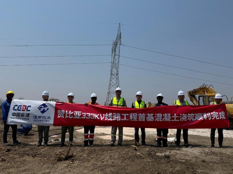
First Foundation Concrete Pour Successfully Completed for Zambia Kafue West–Muzuma 330kV Transmission Line EPC Project
Hot News

评论 (0)