From July 14 to 15, 2025, the Central Urban Work Conference, convened again at a high level after a decade, focused on the modernization of urban governance, emphasized coordinating development and security, and promoted the transformation of cities from "incremental expansion" to "connotative improvement."
The conference explicitly put forward the requirement to "firmly hold the bottom line of urban safety" and listed"striving to build safe and reliable resilient cities" as one of the seven key tasks of urban work. As the core essence of building a modern people's city, "resilient city construction" encompasses both the systematic strengthening of hardware such as infrastructure and the improvement of software such as social governance.It focuses on four key areas—advancing the construction of infrastructure lifeline safety projects, strengthening urban natural disaster prevention, raising the level of housing safety assurance, and enhancing overall public security prevention and control—which address both current prominent problems and plan for long-term development, reflecting a profound grasp of the laws of urban development and highlighting the people-centered value orientation.
Key tasks of the Central Urban Work Conference Image source: self-drawn
01
Guangzhou's practice in resilient city construction
More than 70% of China's cities and over 50% of its population are distributed in areas prone to frequent meteorological, seismic, geological, and marine natural disasters. At present, urban safety risks exhibitdiversified and compoundcharacteristics. Modern lifestyles have strengthened connections between cities and accelerated the flow of factors, while also significantly increasing cities' vulnerability and exposure to various disasters. As the core engine of the Guangdong-Hong Kong-Macao Greater Bay Area and a representative of mega-cities and super-large cities,Guangzhou has taken the lead in coordinating territorial spatial security with the concept of resilient cities,responding to complex and severe urban safety risk challenges and bravely undertaking the innovative重任 of urban risk prevention and disaster response. Guided by the territorial spatial master plan, Guangzhou has proposed the overall goal of "building a safe and resilient city," further strengthening resilience assurance in aspects such as lifeline projects, flood control and tide drainage, and all-hazard emergency response. With urban renewal as a key lever, it carries out fire safety upgrades in historic districts and old residential communities, intensive renovation of aging pipelines, optimization of the transportation network, and strengthening of smart governance, driving continuous exploration and innovation in resilient city construction.
● Strengthening lifeline projects to firmly hold the bottom line of urban safety Guangzhou has taken the lead in carrying out hierarchical planning practice of "master plan-detailed plan-implementation plan" for underground pipelines. The detailed plan covers seven districts across the city, weaving a dense "one network" of underground pipeline planning and scientifically coordinating the simultaneous planning and construction of roads and pipelines spatially. It coordinates the routes of various major sensitive pipelines such as raw water, 500KV power lines, and high-pressure gas, and strengthens safety protection and control requirements. Relying on the pipeline spatiotemporal big data engine, Guangzhou has built a data platform covering more than 98,000 kilometers of ten major categories of underground pipelines across the city, established a desensitized pipeline sharing application model, and promoted underground pipeline data sharing. By realizing unified management of data elements throughout the entire process of "planning-acceptance-database entry" and pioneering the "pipeline excavation joint sign-off" application paradigm, from 2022 to 2024, pipeline network excavation damage accidents in Guangzhou dropped by about 50%, and the safety foundation of underground pipelines has been continuously consolidated. Guangzhou underground pipeline network "one map" Image source: self-drawn Guangzhou underground pipeline intelligent management platform Image source: self-drawn

● Scientific assessment deepens flood governance, rigid control builds happy rivers and lakes Based on plans such as flood control and drainage planning, vertical planning, and flood assessment, Guangzhou incorporates spatial elements such as flood control and drainage facilities, river and stream water systems, minimum vertical control requirements, and sponge storage facilities into land use planning conditions and transmits them to the design, construction, and acceptance stages. Through the flood assessment system, storage capacity of more than 17.66 million cubic meters has been implemented, equivalent to more than 170 small reservoirs. At the same time, the control lines of more than 1,300 rivers and streams and 300 reservoirs across the city have been incorporated into the territorial spatial basic information platform, rigidly implementing the planning control requirements for river and stream water systems and promoting the construction of a flood control and drainage engineering system featuring "upstream storage, midstream retention, external blocking, and decentralized storage." Distribution map of areas prone to potential waterlogging risks in Guangzhou Image source: self-drawn
At the implementation level:By comprehensively using technical means such as remote sensing, LIDAR elevation models, and hydraulic models, Guangzhou has identified and delineated 58 potential waterlogging risk areas across the city. In conjunction with waterlogging governance work, the list of waterlogging-prone points is dynamically updated year by year, and the number of waterlogging risk points has decreased from 474 delineated in May 2021 to 277 at present. At the governance level:Guangzhou continues to promote the resilient governance of "happy rivers and lakes," following the "natural law of the food chain," adopting micro-disturbance habitat design techniques to create habitats such as sandbars, shoals, and wetlands and enhance ecological resilience; at the same time, it deploys automated monitoring networks for water conditions, water quality, and waterlogging accumulation to enhance management resilience. In recent years,Guangzhou has achieved remarkable results in river and lake governance:Nangang River in Huangpu District passed the national "happy rivers and lakes" construction effectiveness assessment; Liuxi River was selected as an excellent case of national "beautiful rivers and lakes"; Paitan River in Zengcheng District was included in the Ministry of Water Resources' 2024 "happy rivers and lakes" construction list. Today, a number of pleasant landscapes featuring harmony between people and water and clear, long-flowing beautiful waters are vividly presented throughout Guangzhou. Nangang River Image source: Guangzhou Water Affairs WeChat official account
● Risk assessment strengthens hidden danger rectification, team building advances governance efficiency Guangzhou has built a fire protection planning system oriented toward all hazards and major emergencies. By coupling hundreds of thousands of historical disaster data records from the past nearly 20 years with an intelligent disaster risk assessment model based on machine learning, it identifies various urban risk sources and vulnerable areas. Targeting different disaster characteristics, it has established9 categories and 22 teamsof professional teams for high-rise, underground, petrochemical, and water areas, and adopts a fire station layout of "one station, multiple points, large leading small" to enhance fire rescue response capabilities. At the same time, in conjunction with urban renewal, it promotesmicro fire safety renovationin historic districts, old residential communities, or urban villages such as Duobao Street in Liwan District and Longfeng Street in Haizhu District, carrying out work such as improving fire facilities, promoting intelligent fire protection systems, and building street wayfinding signs, creating pilot demonstrations of old areas with enhanced emergency rescue capabilities. Fire station layout of "one station, multiple points, large leading small" Image source: self-drawn, Guangzhou Daily Professional team building for "all-hazard major emergency response" Image source: self-drawn

● Optimizing the transformation of the transportation network toward block space and promoting the construction of comfortable and convenient livable cities The renovation of Baiyunhu Avenue and Guanghua Road focuses on promoting urban governance innovation. In the design, roads and buildings are created as an integrated U-shaped urban space: below the road, pipeline space is expanded to strengthen infrastructure resilience and safety redundancy; above the road, perception and governance are made smarter to achieve real-time perception, rapid response, and coordinated linkage of urban roads and improve the adaptive capacity of urban transportation; relying on transportation big data and micro-perception data, non-motorized lanes and shared lanes are added to the road surface to enhance urban transportation resilience; and buildings on both sides of the road and their setback spaces are coordinated to improve urban quality and age-friendliness. While implementing intelligent control of urban road traffic, it promotes spatial control from the road red line to the entire street, enhancing the value of urban space management. Spatial control from road red line to entire street Image source: Baiyun Media Smart-enabled resilient technology application Image source: Guangzhou Baiyun Release


02 Continued efforts in the future
At present, resilient city construction must firmly grasp urban renewal as an important lever, abandon path dependence oriented toward scale, gradually build a resilience framework in quality improvement, functional enhancement, and livelihood improvement, and explore models and means of connotative improvement transformation and governance innovation optimization.
● Adhere to planning guidance and strengthen the dynamic connection between formulation and implementation Strengthen the goal-oriented coordinating and guiding role of planning in serving urban construction,and systematically plan resilient cities as an integrated living entity featuring flexible population mobility, elastic industrial layout, organic urban growth, and resilient interconnected transportation.Through research and formulation of top-level designs such as resilient city planning outlines, promote technical reserves and scientific research for resilient cities, clarify resilient city governance indicators, improve the resilience evaluation system, strengthen the dynamic connection between planning formulation and implementation, enhance the transmission from blueprint to implementation, and promote innovation in urban disaster prevention and resilience governance models.
● With high-quality urban renewal as the carrier, seek systematic breakthroughs in resilient infrastructure In conjunction with urban renewal actions, sort out and identify weak links in urban safety. By superimposing pipeline detection technology with BIM-CIM technology, open up the safety lifelines of infrastructure in areas such as historic districts and old residential communities, and promote the renovation and upgrading of aging pipelines and the construction of composite micro utility tunnels. Strengthen redundant construction of lifeline projects. Newly built and renewed roads should simultaneously complete "dual-circuit" power utility tunnels and dual-pipe water supply mains, and reserve backup capacity at key nodes. Strengthen the interconnected "one network" of partitioned systems such as water supply and power supply to achieve cross-district mutual assistance. Implement spatial protection and risk control for major sensitive pipelines and facilities such as long-distance oil and gas pipelines and high-pressure gas pipelines, and firmly build the safety guarantee of the foundational base of resilient city lifelines.
● Digital and intelligent empowerment of disaster prevention, promoting joint construction, governance, and sharing by all Digitalization empowersthe intelligent governance of resilient cities.By building a multi-source high-precision data foundation, constructing a natural disaster monitoring and hidden danger perception network covering the entire territory, and creating a "macro-meso-micro" three-level dynamic disaster deduction model, it strengthens macro identification of potential risk areas, meso improvement of key areas' ability to withstand beyond-standard disasters, and micro "one point, one policy" support for site selection and demonstration of major infrastructure, achieving early warning before disasters and intelligent response after disasters, promoting the planning and construction of major projects, and advancing urban governance from "passive response" to "active prevention and control."
Mechanism guarantees provide support for the joint construction, governance, and sharing of resilient cities.Focusing on key facilities such as emergency material support,"dual-use for normal and emergency"public infrastructure construction, and emergency shelters, establish a long-term institutional mechanism featuring cross-departmental coordination and multi-departmental linkage, breaking the traditional "compartmentalized" management model. Relying on the urban digital twin foundation, promote the transformation of governance from "experience-driven" to "data-driven" and the leap from "urban management" to "urban governance," guiding resilient city construction to better serve the people and meet livability needs.
Corporate News | CNNC's Excellent Performance Application Practices in Engineering General Contracting Capacity Building
下一篇Industry Exhibition | Gathering Momentum in Kuala Lumpur · Empowering New Opportunities: 2025 Changsha International Construction Equipment Exhibition Southeast Asia Sub-Exhibition, a One-Stop Resource Platform for Deep Expansion into the Southeast Asian Market
2026-09-28 1157 0
2026-09-24 10586 0
2026-09-23 10714 0
2026-09-22 10808 0

Lize City Air Terminal Underground Main Structure Nearing Completion: Maximum Transfer Walk Under 4 Minutes After Operation

Anti-seepage Curtain for Main Lock Pit of CSCEC Port Shenqiu Double-Line Lock Project Completed on Schedule

All Pile Foundations Completed on Quanzhou Baiqi Channel

Hainan Upgrades Housing and Municipal Infrastructure
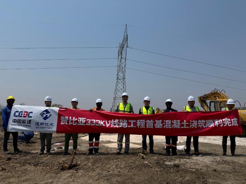
First Foundation Concrete Pour Successfully Completed for Zambia Kafue West–Muzuma 330kV Transmission Line EPC Project
Hot News

评论 (0)