The Guangxi Baise Water Conservancy Hub Navigation Facilities Project, constructed by Yunnan Communications Investment Group, planned in advance and was equipped with building monitoring and geotechnical monitoring systems at the initial stage of scheme design, installing a permanent "health check monitor" for the project's safe construction and navigation operations in one go.

Faced with numerous navigation facilities of varying functions, complex structures, and harsh working environments—such as hundred-meter-high towers bearing tens of thousands of tons overhead, ship lock galleries repeatedly scoured by tens of thousands of cubic meters of water per lockage, and single spoil grounds of nearly ten million cubic meters—how to comprehensively "sense + respond" to the working conditions and states of each engineering structure during construction and after completion, and how to probe the overall safety and reliability of the project throughout its life cycle, are the main challenges currently faced.

Baise Company tackled the difficulties head-on, pooling collective wisdom and efforts to break through the limitations of traditional monitoring technologies and achieve innovative applications in three major aspects: fusion analysis of multi-source data to enable real-time tracking of the observation process; synchronous development of a management and early-warning system platform to achieve multi-dimensional visual presentation of project status, real-time early warning with shortened response times, and improved early-warning efficiency and accuracy; and creation of an intelligent closed loop of "perception-decision-control," directly connecting the monitoring platform to the overall integrated smart navigation system, and through unified data standard interfaces, achieving interconnection with multiple business systems such as navigation scheduling, ship lock control, and safety monitoring.data interoperabilitybuilding a全域 (whole-area) safety network covering "geotechnical stability - facility safety - smooth shipping."

Up to now, while synchronously embedding, installing, and commissioning equipment alongside the main works, the building and geotechnical monitoring of the Baise Navigation Project is striving to achieve further "upgrading," using communication networks for data transmission to realize cloud-based online monitoring and intelligent management and control based on "practical training" of navigation operations, further promoting the leap from manual monitoring to intelligent monitoring, and striving to advance key indicators such as monitoring data integrity rate, early-warning timeliness, and system stability toward more advanced levels, truly safeguarding the "Safe Century Quality Project."

Geotechnical monitoring mainly targets permanent slopes, spoil grounds, and other geotechnical engineering locations, primarily deploying integrated GNSS equipment, fixedinclinometers, piezometric tubes, anchor cable load cells, rebar stress meters, five-direction strain gauges, non-stress meters, etc., to obtain in real time parameters such as slope surface or slope body displacement, groundwater level,rock mass stressand anchor cable/anchor bolt stress of slopes and spoil grounds, assessing the corresponding safety margins through continuous monitoring data and promptly identifying geotechnical hidden dangers; at the same time, using dynamic monitoring during construction to further guide the optimization of construction techniques—that is, through a complete technical chain from data collection, transmission, and analysis to early warning, realizing a "monitoring-analysis-feedback" closed-loop mechanism to meet the requirement of conducting real-time "health checks" for slopes and spoil grounds.
School Selection Guide | School of Civil Engineering, Qingdao University of Technology
下一篇Company News | The "Geotechnical Engineering Handbook," translated and reviewed by the Institute of Foundation Engineering of China Academy of Building Research, Wins the China Architecture & Building Press 2024 Outstanding Imported Book Award

2026-10-18 0 0

2026-10-18 0 0

2026-10-17 0 0

2026-09-23 10598 0
Lize City Air Terminal Underground Main Structure Nearing Completion: Maximum Transfer Walk Under 4 Minutes After Operation
Anti-seepage Curtain for Main Lock Pit of CSCEC Port Shenqiu Double-Line Lock Project Completed on Schedule
All Pile Foundations Completed on Quanzhou Baiqi Channel

Hainan Upgrades Housing and Municipal Infrastructure
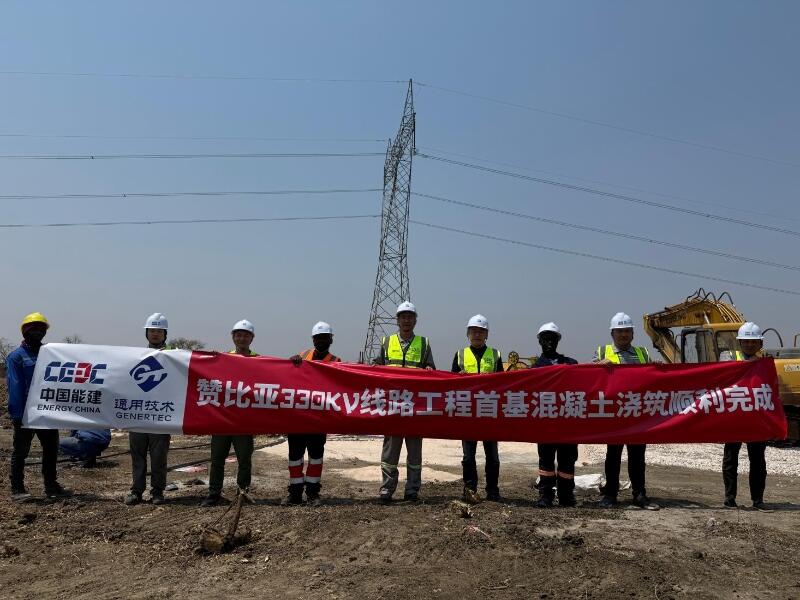
First Foundation Concrete Pour Successfully Completed for Zambia Kafue West–Muzuma 330kV Transmission Line EPC Project
Hot News

评论 (0)