Recently, the team led by Professor Fan Xuanmei at Chengdu University of Technology has made important progress in the intelligent prediction of globally earthquake-induced geological hazards. The related results, titled"Deep learning can predict global earthquake-triggered landslides"were published in the international top journalNational Science Review(NSR, impact factor 16.3).

▲ First page of the paper
(Click the image to view details)
Journal
National Science Review
Publication date
2025.05.09
This study is based on more than 400,000 landslides triggered by 38 strong earthquakes over the past 50 years,and has established the world's largest earthquake-induced landslide database to date,combined with deep learning algorithms to develop an intelligent prediction model that canpredict the spatial probability of earthquake-induced landslides anywhere in the world within one minute, with an average accuracy of 82%. The results can be used to conduct disaster risk scenario simulations for high earthquake-risk areas before earthquakes, and to rapidly assess the spatial distribution of geological hazards after earthquakes, providing important scientific and technological support for pre-earthquake disaster prevention planning and post-earthquake emergency rescue. This achievement not only provides valuable data support for global research on strong-earthquake geological hazards, but also offers a scalable and effective tool and a global demonstration for disaster risk reduction.
Landslides induced by strong earthquakes Disaster risk from a global perspective 01 Strong earthquakes occur frequently worldwide; over the past 20 years, a strong earthquake of magnitude 7 or above has occurred on average once a month globally, claiming approximately 750,000 lives in total. Secondary geological hazards induced by strong earthquakes in mountainous areas are an important cause of earthquake casualties. For example, geological hazards induced by the 2008 Wenchuan M7.9 earthquake caused more than 20,000 deaths, accounting for about one-third of the total earthquake death toll; landslides caused by the 2015 Nepal M7.9 earthquake accounted for more than 40% of total casualties. These geological hazards not only cause direct casualties but also often block roads and communications, seriously affecting post-earthquake emergency rescue. China is the country with the highest earthquake disaster risk in the world, and accurately predicting geological hazards induced by strong earthquakes is of great significance for enhancing China's ability to respond to natural disaster risks.
From "physical mechanisms" to "data-driven" A near-real-time intelligent prediction model for earthquake-induced landslides 02 From a global perspective, do secondary geological hazards induced by strong earthquakes have universal development and distribution patterns and controlling factors? Can a prediction model for strong-earthquake-induced geological hazards applicable to different geological environmental conditions worldwide be established? These are frontier international scientific questions in the field of geological hazards. The traditional Newmark method based on physical mechanisms is only suitable for small-scale assessment due to its high requirements for physical and mechanical parameters. In recent years, with the increase in observational data such as remote sensing, some studies have used statistical methods and machine learning to establish empirical mappings between historical landslide samples and controlling factors. Although this solves the problem of high dependence on physical and mechanical parameters, it also faces severe challenges of insufficient sample representativeness and cross-regional generalization capability. Global earthquake-induced landslide database To achieve truly global prediction, the research team selected 38 typical events from earthquakes of magnitude 6 or above worldwide since 1970, and, combining intelligent remote sensing identification with manual verification, interpreted nearly 400,000 landslide samples, constructing the largest and highest-qualityglobal earthquake-induced landslide databaseto date (Figure 1). ▲ Figure 1 Spatial distribution of global earthquake-induced landslide events since 1970 and seismic belt-climate zoning Furthermore, earthquake events were divided into the Circum-Pacific and Alpine-Himalayan seismic belts, and three major climate zones: cold, temperate, and equatorial, in order to enhance the model's generalization capability under different regional geological environmental conditions. Universal controlling factors of earthquake-induced landslides at the global scale Based on the understanding of the mechanisms of strong-earthquake-induced landslides, this study analyzed 17 influencing factors and found that peak ground acceleration (PGA), slope, and lithology are the dominant controlling factors of earthquake-induced landslides worldwide: PGA directly reflects the intensity of seismic energy release, slope determines the stability threshold of the slope itself, and lithology affects the physical and mechanical properties of the rock and soil mass. It is noteworthy that the landslide controlling factors in different seismic belt-climate zones show significant spatial differentiation (Figure 2): in cold regions, PGA and distance to fault are the dominant factors; in equatorial regions, terrain-ground motion coupling dominates landslide triggering; in temperate regions, PGA-slope-lithology present a态势 of parallel core factors. This regional differentiationreflects the differentiated influence of the synergistic action of geological background and climatic exogenic forces on landslide dynamic processes, breaks through the "one-size-fits-all" limitation of traditional prediction models, and provides pioneering insights for zonal optimization of the model. ▲ Figure 2 Importance analysis of controlling factors of earthquake-induced landslides globally and in different zones Minute-level inference for global earthquake-induced landslide prediction This study innovatively designed a multi-scale fully convolutional regression network, combined with channel-spatial attention modules, to achieve automatic extraction, focusing, and fusion of key features of induced landslides. The model adopts a"global-regional dual-track"deployment strategy (Figures 3 and 4): in regions with abundant events and data such as the equatorial and temperate zones, regional models are used to fully optimize parameters through regionalized training and obtain higher prediction accuracy; while in cold-region scenarios lacking events and samples, the global model is used, which, with massive and diverse training samples, can guarantee a robust prediction lower bound and effectively avoid the risk of overfitting. ▲ Figure 3 Spatial probability prediction of landslides induced by typical strong earthquakes in five global seismic belt-climate zones ▲ Figure 4 Accuracy evaluation and comparison of earthquake-induced landslide prediction based on global and zonal models Compared with traditional mechanistic and statistical models, this method has made significant breakthroughs in both accuracy and computational efficiency, with an averageprediction accuracy of 82%, about 20% higher than existing international models,and computation time shortened from several days to less than 1 minute, achieving near-real-time prediction of earthquake-induced geological hazards.


Outlook 03 The research will further improve the model's prediction accuracy and response speed by exploring"mechanism-and-data jointly driven"methods. In the future, it is expected to incorporate more triggering conditions such as rainfall forecasts and aftershock analysis into the prediction model, and at the same time combine data on population, buildings, and infrastructure to realize a multi-factor-driven large model for geological hazard risk prediction, providing a Chinese solution for global disaster prevention and reduction.
Highlights 04 This study constructed thefirst global earthquake-induced landslide database,systematically revealed the development and distribution patterns and key controlling factors of landslides globally and in different seismic belt-climate zones, and innovated a near-real-time intelligent prediction model for earthquake-induced landslides based on deep learning algorithms. It is a successful demonstration of artificial intelligence application in the field of geological hazards, and provides important support for post-earthquake emergency response and pre-earthquake scientific planning for global earthquake disasters. Postscript: The original aspiration of 17 years of exploration of earthquake-induced landslides 17 years ago, Fan Xuanmei entered the Wenchuan earthquake area and witnessed with her own eyes the mountains collapsing and the earth cracking, and the devastation everywhere 17 years later, the team she leads has transformed these "memories" into high-precision digital prediction maps From the footprints of surveys deep into the disaster areas to the construction of a world-class earthquake landslide prediction platform, this path has both the weight of soil and the sharpness of code. With scientific spirit and tenacious perseverance, they have provided a "God's-eye view" for global geological hazard emergency response. Today, this achievement is spreading from China to the world, becoming a leading benchmark for geological hazard risk prediction. (Click the image to view details)
Industry News | Eight Departments Including the China Association for Science and Technology Jointly Issue the Notice on the 2025 Key Work Points for National Science Ethics and Academic Atmosphere Construction Outreach and Education
下一篇Horizon Construction Development Completes Acquisition of Controlling Stake in Malaysia's TH Tong Heng Machinery, Setting a New Benchmark for Belt and Road Strategic Cooperation
2026-09-28 1157 0
2026-09-24 10586 0
2026-09-23 10714 0
2026-09-22 10808 0

Lize City Air Terminal Underground Main Structure Nearing Completion: Maximum Transfer Walk Under 4 Minutes After Operation

Anti-seepage Curtain for Main Lock Pit of CSCEC Port Shenqiu Double-Line Lock Project Completed on Schedule

All Pile Foundations Completed on Quanzhou Baiqi Channel

Hainan Upgrades Housing and Municipal Infrastructure
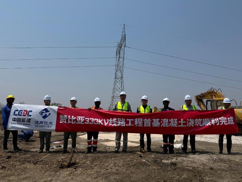
First Foundation Concrete Pour Successfully Completed for Zambia Kafue West–Muzuma 330kV Transmission Line EPC Project
Hot News

评论 (0)