In recent years, as a domestic super-large comprehensive engineering survey and design enterprise, China Railway Eryuan Engineering Group (CREEG) has consistently taken the development of new quality productive forces as an inherent requirement for promoting high-quality development, accelerated the concentration of cutting-edge technologies in the traditional geological survey field, and with digital and intelligent technological innovation as a key focus, successfully built a digital geological survey system. This has enabled engineering geological survey to accelerate its transformation toward high technology, high efficiency, and high quality, accumulating stronger "digital-intelligent" momentum for the development of modern engineering technology.

What is the digital geological survey system?
Adhering to the working philosophy of "climbing to the summit when going uphill and reaching the bottom when going down into valleys," CREEG's geological survey personnel established a comprehensive "sky, air, ground, and borehole" survey system for complex and treacherous mountainous areas to solve the technical challenges faced by traditional survey methods, turning many "impossibilities" into "possibilities" and "conceptions" into "realities," and contributing CREEG's strength to the development of cutting-edge geological survey technologies.
As geological survey methods have become increasingly diverse, heterogeneous, multi-dimensional, massive, and complex geological survey data have also brought new challenges to data collection, analysis, application, and expansion. To better explore and utilize the "treasure trove" of geological survey data, CREEG independently developed and established a geological data center for centralized collection, storage, processing, and distribution services using technical means such as geographic information, 3D modeling, the Internet of Things, and big data. On this basis, it built a functional platform encompassing application scenarios such as survey, design, construction, operation and maintenance, emergency rescue, and management, achieving "integrated" application and management of geological survey data throughout the entire life cycle of infrastructure construction and opening up a broader horizon for geological data applications.
How does the digital geological survey system operate?

One center
The geological data center is the "brain" and "central nervous system" of the digital geological survey system. It uses information technologies such as cloud computing and big data to store, manage, analyze, and publish massive data from basic geology, field mapping, exploration, photography, and experiments, connecting six functional platforms to achieve efficient data sharing and collaboration.
Six platforms
Collection platform — the "versatile expert" for integrating survey data
As the "versatile expert" for collecting survey data, the data collection platform is an integrated platform that collects and organizes all geological survey information and data in the survey and design stage and digitizes and structures them. It conducts field data collection through the APP end and in-office data management and analysis through the WEB end, coordinating multi-platform data sharing to achieve efficient collaboration in survey work.
Processing platform — the "central kitchen" for intelligent geological survey
The data processing platform is a centralized processing platform for handling multi-source, multi-dimensional, and heterogeneous data in the survey and design stage. It can efficiently perform statistics, application, analysis, and annotation on raw geological materials such as remote sensing, mapping, drilling, geophysical prospecting, in-situ testing, and laboratory experiments, and automatically generate required charts, documents, and the like, achieving functions such as intelligent processing of engineering geological data.
Display platform — the "interactive tool" for comprehensive geological survey analysis
The data display platform can comprehensively analyze geological information in the survey and design stage and integrate data from remote sensing, drilling, testing, geophysical prospecting, BIM, and in-situ testing. With the help of artificial intelligence, it implements multiple intelligent modules such as intelligent landslide identification, hyperspectral lithology identification, and surrounding rock classification, enabling 3D visualization display and interaction between geological technicians and geological data, thereby improving comprehensive analysis capabilities.

Advanced forecasting platform — the "data steward" for dynamic tunnel design
The tunnel advanced geological forecasting platform integrates functions such as forecast design, data collection, process management, geological hazard display, comprehensive analysis, and risk warning. It can not only efficiently manage various types of geological information obtained during tunnel construction but also provide technical support for dynamic tunnel design and geological hazard prevention.

Monitoring platform — the "early warning radar" for engineering geological hazards
The geological hazard monitoring and early warning platform can use various sensor devices to monitor surface deformation, deep underground deformation, groundwater level, stresses on prevention and control works, rock and soil mass stress, rainfall, relative displacement of cracks, anchor bolt axial force, displacement within the surrounding rock mass, and seepage pressure throughout the entire life cycle of engineering construction, and provide monitoring and early warning information for the prevention and control of geological hazards such as landslides, debris flows, collapses, dangerous rockfalls, tunnel floor heave and deformation, and ground subsidence and settlement.

Management platform — the "all-capable secretary" for geological exploration work
The geological survey management platform can manage the entire exploration process, enabling dynamic scheduling of plans, real-time updating of engineering quantities, and one-click download of engineering materials. At the same time, an intelligent video monitoring and early warning module for survey field operations has been developed in parallel, which can provide remote monitoring and intelligent reminders for exploration operations, not only improving the efficiency of survey management but also providing support for optimizing resource allocation across multiple projects.
What functions does the digital geological survey system have?
The digital geological survey system has changed the data collection, management, and application methods of traditional geological exploration work, improved the efficiency of data aggregation and circulation, and achieved automated collection, intelligent analysis, and systematic application of engineering geological information. It has enhanced the quality and efficiency of engineering geological work and the capacity for shared services, and is an intelligent assistant for realizing the transformation of geological work.
Automated information collection
Information acquisition is more diverse. On the basis of traditional geological survey methods, the system introduces more advanced technologies, tools, and data in the "air, sky, ground, and borehole" domains, such as full airborne geophysical prospecting and semi-airborne geophysical prospecting, making engineering geological information sources more diverse, methods more advanced, and information more abundant.

Data collection is more convenient. The system uses APP-based collection of basic field data such as field geological mapping and drilling, achieving immediate availability of field data upon collection. It uses mobile phone photography to collect surrounding rock images of tunnel faces, automatically realizing lithology identification and structural plane identification, and enabling intelligent generation of tunnel advanced geological forecast face sketches.

Intelligent data analysis
Data processing is more efficient. Built-in distributed data preprocessing and information extraction algorithms conduct in-depth mining and analysis of geological data, rapidly processing and transforming traditional geological survey data such as documents, drawings, and images into structured and spatialized data, saving a great deal of time required for manual processing.
Data analysis is more intelligent. In the survey stage, it achieves integrated drawing of plan views, integrated drawing of longitudinal sections, automatic mutual generation of cross-sections and longitudinal sections, inclined borehole drawing, non-mainline section matching, and intelligent stratification of static cone penetration tests; in the construction stage, it uses high-resolution deep neural network algorithms to achieve intelligent and rapid surrounding rock classification under comprehensive analysis of multi-dimensional factors, providing reference and basis for geological analysis.
Systematic application of materials
Information application is more integrated. The system integrates intelligent geological analysis algorithms, data mining technology, and 3D earth visualization technology, achieving integrated data fusion processing of above-ground and underground data, expanding analysis dimensions and data volume, providing a data and algorithm foundation for interdisciplinary analysis, and realizing 3D visualization of forecast data and survey data to assist professionals in intuitively analyzing geological problems.
Data utilization is more in-depth. The system places greater emphasis on the mining and utilization of geological data throughout the entire engineering construction process. In particular, for long-term engineering operation and maintenance management, the system achieves data connectivity across various stages including feasibility study, survey, design, construction, operation and maintenance, and monitoring. By using technologies such as intelligent sensing, the Internet of Things, and cloud computing, it can provide scientific basis and precise data support for disaster warning and emergency response.
Application of the digital geological survey system
At present, the digital geological survey system has been widely applied in multiple projects undertaken by CREEG, including the Plateau Railway, Jizao High-Speed Railway, Wenjing Railway, and the second line of the Guizhou-Guangxi Railway. Starting from the initial field geological investigation, advanced positioning and data collection technologies have been adopted, combined with AI-assisted lithology identification and rock mass structure information collection, making the records of each observation point more precise and efficient. In drilling operations, innovative drilling techniques and equipment have greatly improved core drilling efficiency, and newly designed sensors enable more comprehensive and detailed acquisition of geological information. In remote sensing interpretation, intelligent algorithms and 3D models can deeply mine data features and provide more insightful interpretation conclusions on adverse geology. In results presentation, automated algorithms and comprehensive visualization methods are used in drawing preparation and report writing, making results presentation more vivid, clear, and accurate.
In the future, CREEG will also accelerate the consolidation of the foundation of independent core technologies for geological survey, strengthen forward-looking and leading research, deeply explore the cross-integration of geological survey data and artificial intelligence analysis, enhance the digital-intelligent service capacity of geological survey, and build a digital "library" for underground space engineering, enabling "engineering geological data archives" to comprehensively support intelligent survey and design, better serve engineering operation and maintenance risk prevention, and inject geological survey strength into the development of modern engineering technology and the building of a transportation powerhouse.
NPU Holds Promotion Meeting on "1→0" Research on Fundamental Problems in Major Engineering
下一篇Pile Foundation Construction Completed for Dahe Grand Bridge on Hubei Lixian Expressway

2026-09-28 1137 0

2026-09-24 10491 0

2026-09-23 10629 0
2026-09-22 10708 0

Lize City Air Terminal Underground Main Structure Nearing Completion: Maximum Transfer Walk Under 4 Minutes After Operation

Anti-seepage Curtain for Main Lock Pit of CSCEC Port Shenqiu Double-Line Lock Project Completed on Schedule

All Pile Foundations Completed on Quanzhou Baiqi Channel

Hainan Upgrades Housing and Municipal Infrastructure
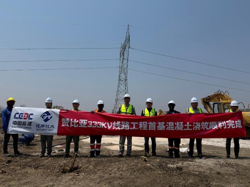
First Foundation Concrete Pour Successfully Completed for Zambia Kafue West–Muzuma 330kV Transmission Line EPC Project
Hot News

评论 (0)