Recently, the official website of the National Maritime Safety Administration published the "Navigational Notice on the Designation of a Temporary Safety Operation Area for Survey Operations of the Bohai Strait Cross-Sea Channel Project," designating a temporary safety operation area for project survey work in the waters near Beihuangcheng Island, where vessels conduct geological survey operations. This is the second time the authorities have issued a survey notice, following the first release in August 2022.
As the work related to the construction of the Bohai Strait Cross-Sea Channel enters a new stage, the new research achievement "Research on the Bohai Strait Cross-Sea Channel and National Regional Development Strategy" has also attracted widespread attention.

This research is a forward-looking, strategic, and systematic study carried out by the research group on the basis of prior research, actively serving major national strategies, closely integrating cross-sea channel construction with regional development strategies, and focusing on channel construction in Northeast Asia and along the "Belt and Road," coordinated development of the Bohai Rim region, revitalization of the old industrial base in Northeast China, and the sustainable development of the two major peninsular regions of Liaoning and Shandong.

Experts believe that the construction of the cross-sea channel project will strengthen economic ties between cities in Shandong and Northeast China at both ends, and is expected to form an emerging cross-sea urban agglomeration, promote comprehensive, coordinated, and integrated development of the regions on the north and south sides of the strait, form a three-tier "dumbbell" structure, and reshape China's regional economic landscape.
Research on the Bohai Strait Cross-Sea Channel is a major and far-reaching research topic proposed for the economic and social development of China's eastern coastal region and the country as a whole in the 21st century.
Its basic concept is to leverage the favorable geographical conditions of the Bohai Strait to build a direct and rapid passage across the Bohai Strait from Penglai in Shandong, via the Changshan Islands, to Lüshun in Liaoning, using cross-sea bridges, subsea tunnels, or a combination of bridges and tunnels, turning the gap in the C-shaped transport network into a fully connected Φ-shaped network, converting a natural barrier into a thoroughfare, and thereby forming a major east China highway and railway transport artery running north-south across eleven provinces (municipalities and autonomous regions) from Heilongjiang to Hainan, with a total length of more than 5,700 kilometers.
In recent years, the project has been incorporated multiple times into various development plans, including the "Outline of the National Comprehensive Three-Dimensional Transport Network Plan," the "Opinions of the State Council on Several Major Policy Measures to Support the Revitalization of Northeast China in the Near Term," the "Medium- and Long-Term Development Plan for the Comprehensive Transport Network of Shandong Province (2018-2035)," and the "Outline for Cooperative Development of the Bohai Rim Region."

In the Outline of the National Comprehensive Three-Dimensional Transport Network Plan, the Bohai Strait Cross-Sea Channel is also one of the three major cross-sea channels planned for construction in China over the next 15 to 30 years (the other two being the Qiongzhou Strait Cross-Sea Channel and the Taiwan Strait Cross-Sea Channel). It was first proposed in 1992 and has undergone more than 30 years of continuous research and demonstration.
According to the preliminary research plan, the cross-sea channel is approximately 125 kilometers long, with an estimated total investment of more than 300 billion yuan. It will set multiple world records (the longest existing subsea tunnel is 54 kilometers) and is an ultra-long-distance cross-sea project never before built in human history.

The straight-line distance between the Liaodong Peninsula and the Shandong Peninsula is only just over 100 kilometers. At present, traveling from Yantai to Dalian by highway covers about 1,400 kilometers and takes about 15 hours; by high-speed train, it requires a transfer in Tianjin and takes about 10 hours; and via the Yantai-Dalian railway ferry, the sea voyage takes about 6-8 hours. If the Bohai Bay cross-sea channel is completed, the entire journey could be shortened to about 1 hour.
Construction Method for Bored Piles in Hard Limestone Strata Using Rotary Drilling Rigs
下一篇Welcome to Join the China Foundation Engineering Technology Innovation Intellectual Property Alliance

2026-10-18 0 0

2026-10-18 0 0

2026-10-17 0 0

2026-09-23 10598 0
Lize City Air Terminal Underground Main Structure Nearing Completion: Maximum Transfer Walk Under 4 Minutes After Operation
Anti-seepage Curtain for Main Lock Pit of CSCEC Port Shenqiu Double-Line Lock Project Completed on Schedule
All Pile Foundations Completed on Quanzhou Baiqi Channel

Hainan Upgrades Housing and Municipal Infrastructure
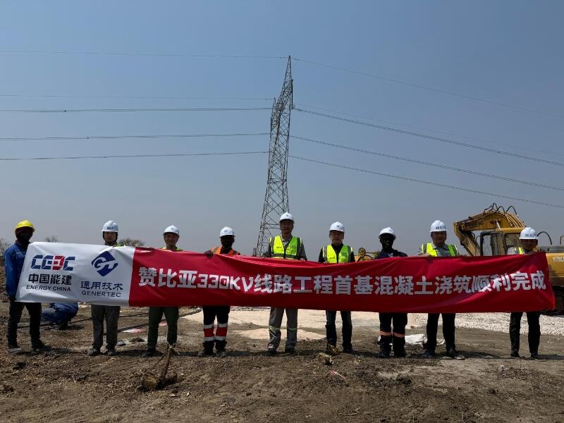
First Foundation Concrete Pour Successfully Completed for Zambia Kafue West–Muzuma 330kV Transmission Line EPC Project
Hot News

评论 (0)