“As long as there is a glimmer of hope, we will never give up.” Three days have passed since the catastrophic landslide in Diexi Town, Mao County, Sichuan on “6.24”, but the rescue command center continues to organize rescue workers to search and rescue scientifically by all means.
Currently, according to the published list of missing persons, 15 out of 118 people have been contacted by phone and reported safe. For the villagers of Xinmo Village in Diexi Town who experienced this catastrophic landslide, the small village that was once filled with the fragrance of pepper and located at the mouth of the picturesque Songping Valley has now disappeared.
To prevent further geological disasters, at the seventh press conference held in Mao County on June 26, it was announced that Aba Prefecture has fully implemented measures such as hazard elimination, emergency avoidance, and round-the-clock monitoring throughout its territory. For newly discovered hidden dangers, all necessary measures are being taken to ensure the safety of people's lives and property.
Data shows that Xinmo Village in Diexi Town is on the necessary route from Chengdu to Jiuzhaigou and Huanglong, and has withstood the tests of two major earthquakes: the 7.3-magnitude earthquake on August 25, 1933, and the 8.0-magnitude earthquake on May 12, 2008. Currently, the village is a new village rebuilt or reconstructed on the original site after the 5.12 Wenchuan earthquake.
“Xinmo Village in Diexi Town, Mao County, where the landslide occurred, is located between Lianghekou and Diexi Haizi in Songping Valley, a tributary of the Min River. The 1933 Diexi earthquake not only formed barrier lake groups near Diexi on the main stream of the Min River but also formed barrier lake groups such as Baila Lake in Songping Valley, a tributary of the Min River. Songping Valley flows downward into Diexi Xiaohaizi (Xiahaizi). The river blockage caused by this landslide is at the lower reaches of Songping Valley near Diexi Haizi,” analyzed geological expert Fan Xiao. He said that this area is a high mountain and gorge region, and for hundreds or even thousands of years, the unique geological structure has always been prone to geological disasters such as landslides and collapses.
But why was this major collapse not detected beforehand? At a press conference held on June 25, Professor Xu Qiang, a geological disaster emergency expert from the Ministry of Land and Resources, explained that the reason no hidden danger was detected in Xinmo Village during the province-wide exhaustive investigation was objectively because the mountain that collapsed is over 3,400 meters above sea level, with a height difference of 1,250 meters from the affected village. It is uninhabited and the mountain is steep, making it difficult for people to climb. Although the land and resources department conducted many investigations after the Wenchuan earthquake, current investigations mainly rely on manpower, with geological personnel conducting surveys only up to certain heights. What happens at inaccessible heights is difficult to know. In addition, the collapsed area has dense vegetation, which obscures the view, making it difficult even for high-precision satellite remote sensing to capture the deformation of the slope. Existing remote sensing methods can hardly detect hidden dangers.
In fact, after the 2008 Wenchuan earthquake, according to Document No. 15 issued by the Sichuan Provincial Government on February 12, 2009, the Sichuan Provincial Department of Land and Resources required intensified efforts in emergency hazard elimination and relocation for geological disasters. At that time, there were 2,300 major geological hazard points in the affected areas that needed treatment, and 3,695 grassroots monitoring and prevention networks were damaged. Therefore, the Department of Land and Resources required “for geological hazard points included in the plan and requiring relocation, decisive relocation measures should be taken to proactively avoid the threat of hidden dangers.”
Whether Xinmo Village in Diexi Town is a planned relocation point cannot be proven by current data. However, according to Pei Xiangjun, a geological disaster emergency expert from the Ministry of Land and Resources, determining whether to relocate requires soliciting the opinions of the local residents. Before the geological disaster, Xinmo Village had a low population density. Compared with surrounding villages, its production and living conditions were quite good, with pepper cultivation and tourism industries. Before the geological disaster, people were unwilling to move to places with inconvenient living conditions.
In this regard, geological expert Fan Xiao believes that after the “5.12” reconstruction, most areas in Sichuan's affected regions included in relocation plans have undergone ecological migration. However, people in this area have been accustomed to living halfway up or at the foot of the mountains for thousands of years. In particular, many Qiang villages have survived earthquakes without major damage, indicating that the local living environment and village scale are already well adapted. In addition, the villages are now supported by tourism and cash crops such as pepper and medicinal herbs, so the willingness to relocate is low and relocation is difficult. “Whether this major collapse will trigger a new round of ecological migration still needs to be analyzed based on large-scale investigations, and it may involve some areas,” Fan Xiao said.
Regarding this major landslide, Fan Xiao believes that with data indicating over 8 million cubic meters, there should have been some warning signs, such as frequent rockfalls, cracks, or heavy rain erosion. “After the 5.12 Wenchuan earthquake, large-scale investigations were certainly conducted, but in nearly 10 years, the mountain must have undergone many changes,” Fan Xiao said.
In response, Pei Xiangjun explained that the geological disaster occurred in the Songping Valley fault zone, where earthquakes have been frequent historically, including the 1933 Diexi earthquake and the 2008 “5.12” Wenchuan earthquake. The 1933 Diexi earthquake had a greater impact on the area than the Wenchuan earthquake. Earthquakes cause deep rock mass damage, or “internal injuries,” rather than “skin diseases.”
Xu Qiang also believes that several major earthquakes are related to this disaster. The Wenchuan earthquake caused cracking and loosening of the mountain. Once it rains, it can trigger geological disasters. At the same time, the high mountains lead to a high-rise amplification effect (whip effect), meaning the top of the mountain deforms more due to the earthquake, just like the tip of a whip.
In addition, strong earthquakes have long-term effects. A major earthquake often has an impact for decades; for example, the 1923 Great Kanto earthquake in Japan had an impact for 60 years. Only 9 years have passed since the Wenchuan earthquake, and we must prepare for long-term disaster prevention.
According to arrangements by Sichuan Province, a geological hazard investigation team has been set up around the landslide area and is investigating surrounding hazards. Next, more high-tech means will be used for monitoring, including satellites, aircraft, and drones, to gradually discover hidden dangers and avoid disasters as much as possible.
“For scattered communities still living at the foot of the mountains, it is also necessary to strengthen interaction with local governments, conduct scientific monitoring of the mountains, and form early warning and emergency plans to prevent geological disasters from threatening people's property and lives,” Fan Xiao said.
Construction Begins Today on Wuxi Section of Suzhou-Wuxi-Changzhou South Expressway: 11-Kilometer Tunnel to Be Built Beneath Taihu Lake
下一篇Small Sachet Chili Oil Packaging Machine, Yueyang Chili Oil Packaging Machine
2026-09-28 1157 0
2026-09-24 10586 0
2026-09-23 10714 0
2026-09-22 10808 0

Lize City Air Terminal Underground Main Structure Nearing Completion: Maximum Transfer Walk Under 4 Minutes After Operation

Anti-seepage Curtain for Main Lock Pit of CSCEC Port Shenqiu Double-Line Lock Project Completed on Schedule

All Pile Foundations Completed on Quanzhou Baiqi Channel

Hainan Upgrades Housing and Municipal Infrastructure
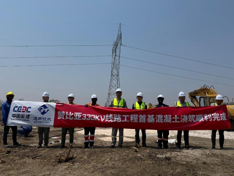
First Foundation Concrete Pour Successfully Completed for Zambia Kafue West–Muzuma 330kV Transmission Line EPC Project
Hot News

评论 (0)